
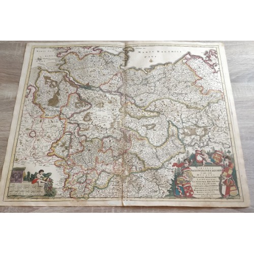
LOWER SAXONY GERMANY 1688 FREDERIC DE WIT UNUSUAL ANTIQUE COPPER ENGRAVED MAP
LOWER SAXONY GERMANY 1688 FREDERIC DE WIT UNUSUAL ANTIQUE COPPER ENGRAVED MAP
Circulus Saxoniж Inferioris in quo sunt Ducatus Holsatiж, Mecklenburgi, Lauwenburgi, Luneburgi, Brunsuigi, Bremж et Ferdж, Comitatus Dannebergi, Archiepiscopatus Maegdenburgensis, Episcopatus Hildesiж et Halberstad Per F. de Wit.
Description: Striking and highly detailed interesting 1688 Frederik de Wit's copper engraved map of Lower Saxony in Germany. Inside the map are also the neighbouring regions of Westfalia, Luneburg, Meklenburg, Bremen, etc. The entire region is depicted in extraordinary detailed, offering both topographical and political information, with cities, towns, villages, rivers, lakes, roads, islands, sandbanks and forests.
The magnificent title cartouche is embellished with 7 coats of arms, cherubs and wodly landscape. A fountain-style cartouche embellished with a cherub handing a cornucopia with fruits includes two mileage scales.
Date: 1688 ( undated )
Dimension: Paper size approx.: cm 60,1 x 51,4
Condition: Very strong and dark impression on good paper. Paper with chains and wiremarks. Map old original colored. Wide margins. Corners partially missing. Small foxing and browning. Small tears. Small warmings affecting the map repaired on the verso. Minor loosing of the text of the map. Map partially reinforced on the verso. Map folded. Conditions are as you can see in the images.
Mapmaker: Frederik de Wit (1629 - 1706) was a Dutch Golden Age cartographer active in the second half of the 17th and the early 18th centuries.
LOWER SAXONY GERMANY 1688 FREDERIC DE WIT ANTIQUE COPPER ENGRAVED MAP
- Product Code: 10721
- Availability: In Stock