
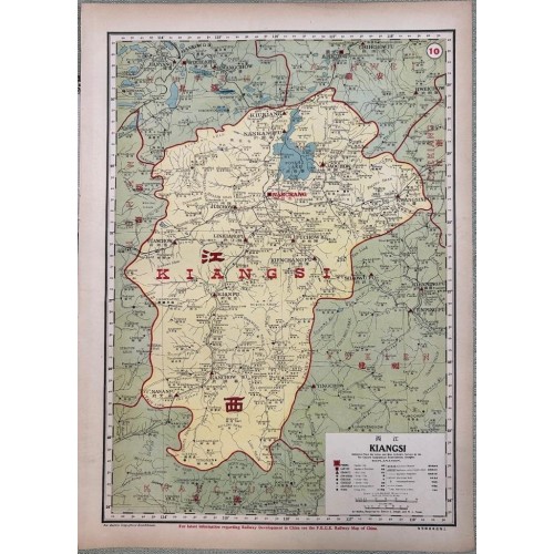
Kiangsi (Jiangxi) China Antique Original Colored Lithographic Engraved Map 1917 Dingle
Description
Kiangsi Compiled From the Latest and Most Authentic Survey by the Far Eastern Geographical Establishment, Shangai.
This map was created by the Far Eastern Geographical Establishment and John Edwin Dingle in 1917. It is part of an atlas published by North-China Daily News & Herald, Ltd., measuring 35 cm by 50 cm. The map represents Jiangxi Province in China with a scale of 1:1,676,850.
This map is part of a national atlas, which combines text, maps, and graphics to present a comprehensive view of China’s geography and economy. The atlas contains numerous visualizations of statistical data, reflecting the era’s interest in economic and trade analysis through geographical representation.
Description: Striking and highly detailed interesting original colored lithographic map of Jiangxi, China. The map notes cities, towns, roads, rivers and lakes as well as administrative divisions. A block-style title cartouche include a legend key & two mileage scales adorn the map. Text in English and Chinese.
Date: 1917 ( undated )
Dimension: Paper size approx.: cm 38,8 x53,7
Condition: Very strong and dark impression on good paper. Map old original colored. Small foxing and browning. Map folded. Conditions are as you can see in the images.
Mapmaker: Edwin John Dingle was an English journalist, author and founder of the Institute of Mentalphysics in California, US.
Kiangsi (Jiangxi) province China Antique Original Colored Lithographic Engraved Map 1917 Dingle
- Product Code: 3726
- Availability: In Stock