
NEEDS NEW PICTURE
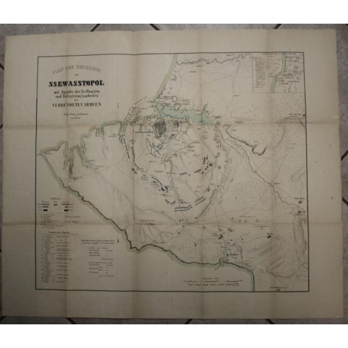
SEVASTOPOL CRIMEAN PENINSULA 1856ca CARL FLEMMING LARGE ANTIQUE.LITHOGRAPHIC MAP
ANTIQUE ORIGINAL LITHOGRAPHIC WAR MAP OF SEVASTOPOL
Condition:
--not specified
Jan 04, 2023 21:21:34 PST
SEVASTOPOL CRIMEAN PENINSULA 1856ca CARL FLEMMING LARGE ANTIQUE.LITHOGRAPHIC MAP
Description
Plan der Umgebung von Ssewasstopol mit Angabe der Stellungen und Belagerungsarbeiten der Verbьndeten Armeen Dunk u. Verlag von C. Flemming in Glogau.
Description: Striking and highly decorative interesting 1856 approx. Carl Flemming's original lithographic large-format map fetauring an aerial plan of Sevastopol, Crimean Peninsula, at the time of the Crimen Peninsula. The plan shows the city with his building, harbor and town walls. The map is filled with with rivers, roads, bays, reliefs as well as the location of the Naval Fleets during the War. An inset map of the Battle of Alma, two mileage scales and eaxplanation keys complete the sheet.
Date: 1856 approx. ( undated )
Dimension: Plate size approx.: cm 82,4 x 70,1
Condition: Very strong and dark impression on good paper. Map old original colored. Small foxing. Browning along the foldings. Small amrginal tears. Map folded. Conditions are as you can see in the images.
Mapmaker: Carl Flemming (fl. c. 1840 - c. 1879) was a German cartographer and map publisher active in the late 19th and early 20th centuries. The firm was an early adopter of modern multicolor printing techniques, which it utilized to produce low cost attractive maps focused on the German market. The firm is also known for its children's books. Flemming died in 1878 or 1879, but his firm continued to publish well into the 20th century. Flemming was based in Glogow, a region that is currently part of modern day Poland's Lower Silesian Voivodeship.
SEVASTOPOL CRIMEAN PENINSULA 1856ca
- Product Code: 11702
- Availability: In Stock