
📢 Guaranteed original 1800 printing. Not a modern reproduction.
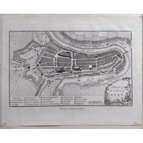
📌Plan of the City of Bern Фntique copper-engraved map , published by John Stockdale in Piccadilly, London, 1800
"A Plan of the City of Bern"
📖 Description: A detailed historical plan of the old city peninsula of Bern, Switzerland, surrounded by the Aare River (Aar River), complete with historic fortifications, bastions, bridges, and key landmarks. [1, 2]
Originally engraved by John Andrews around 1771 (first appearing in A Collection of Plans of the Capital Cities of Europe), with the plates later acquired and re-issued by John Stockdale in 1800 within his geographical and historical works.
Title Cartouche: Located in the lower right with decorative scenery (A Plan of the City of Bern).
Scale Bar: Located just to the left of the cartouche ("Scale of 1500 Feet").
References Legend: Listed at the bottom left with letters A through T pointing out churches, hospitals, gates, the town hall, the great clock (Zytglogge), and the post office
📆Date: 1800 ( undated )
🖼 Dimension: Paper size approx.: cm 23 x 29 cm ( image - 15,5 x 25,5 cm)
📌Condition: Very strong and dark impression on good paper. Conditions are as you can see in the images.
Plan of the city of Bern-Switzerland-Stockdale-Copperplate Engraving - 1800
- Product Code: 10901
- Availability: In Stock