
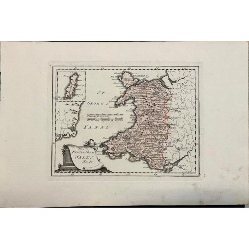
WALES 1789 VON REILLY UNUSUAL ANTIQUE ORIGINAL COPPER ENGRAVED MAP
Das Furstenthum Wales Nro. 85.
Description: Striking and highly detailed fine unusual 1789 Franz Johann Joseph von Reilly's copper engraved map of Wales. Covers also the southeastern England and the easterncoast of Ireland. The map also include an inset map of Isle of Man to the top left side. The map is filled with excellent topographic details on cities, towns, rivers, lakes, roads and regional divisions. A monument-style title cartouche and two mileage scales complete the map.
From Reilly's "Schauplatz der fьnf Theile der Welt", an atlas with over 1000 maps in total. He became famous for the accuracy and high level of detail of the maps and was published in three parts between 1789 and 1806 in Vienna.
Date: 1789 ( undated )
Dimension: Paper size approx.: cm 46,1 x 30,4
Condition: Very strong and dark impression on good paper. Paper with chains. Map old original colored. Wide margins. Small foxing and browning. Conditions are as you can see in the images.
Mapmaker: Franz Johann Joseph von Reilly (1766-1820) was an Austrian publisher, cartographer and writer. At first he worked in the civil service, but then devoted himself exclusively to geography.
WALES 1789 VON REILLY UNUSUAL ANTIQUE ORIGINAL COPPER ENGRAVED MAP
- Product Code: 5824
- Availability: In Stock